Old Boundary Marker by the A6, Preston Road, Whittle-le-Woods,
Introduction
The photograph on this page of Old Boundary Marker by the A6, Preston Road, Whittle-le-Woods, by Milestone Society as part of the Geograph project.
The Geograph project started in 2005 with the aim of publishing, organising and preserving representative images for every square kilometre of Great Britain, Ireland and the Isle of Man.

There are currently over 7.5m images from over 14,400 individuals and you can help contribute to the project by visiting https://www.geograph.org.uk
Old Boundary Marker by the A6, Preston Road, Whittle-le-Woods,
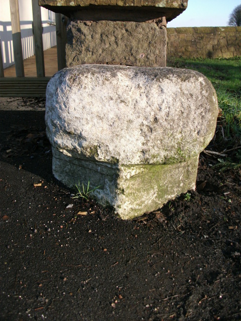
Image: © Milestone Society Taken: Unknown
Parish Boundary Marker by the A6, in parish of Whittle-le-Woods (Chorley District), Preston Road, opposite junction with Buckshaw Avenue, in front of South wall to Sea View Public House. Surveyed Milestone Society National ID: LA_CYPS02pb
Images are licensed for reuse under creativecommons.org/licenses/by-sa/2.0
Image Location
Latitude
53.673537
Longitude
-2.634237