Old Wayside Cross - moved to Wrangaton Road
Introduction
The photograph on this page of Old Wayside Cross - moved to Wrangaton Road by Alan Rosevear as part of the Geograph project.
The Geograph project started in 2005 with the aim of publishing, organising and preserving representative images for every square kilometre of Great Britain, Ireland and the Isle of Man.

There are currently over 7.5m images from over 14,400 individuals and you can help contribute to the project by visiting https://www.geograph.org.uk
Old Wayside Cross - moved to Wrangaton Road
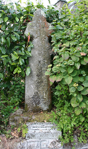
Image: © Alan Rosevear Taken: 18 Jun 2010
Wrangaton Cross, old head, shaft and base, Starkey No.94 by the UC road, in parish of Ugborough (South Hams District), Wrangaton House, Wrangaton Road, junction with Blacksmith Lane, on raised hedge bank and wall. Grade II listed. List Entry Number: 1168429 https://historicengland.org.uk/listing/the-list/list-entry/1168429 Surveyed Milestone Society National ID: DVSH_UGB01
Images are licensed for reuse under creativecommons.org/licenses/by-sa/2.0
Image Location
Latitude
50.40588
Longitude
-3.863469