Old Wayside Crosses in St Bridget's churchyard, Beckermet
Introduction
The photograph on this page of Old Wayside Crosses in St Bridget's churchyard, Beckermet by Milestone Society as part of the Geograph project.
The Geograph project started in 2005 with the aim of publishing, organising and preserving representative images for every square kilometre of Great Britain, Ireland and the Isle of Man.

There are currently over 7.5m images from over 14,400 individuals and you can help contribute to the project by visiting https://www.geograph.org.uk
Old Wayside Crosses in St Bridget's churchyard, Beckermet
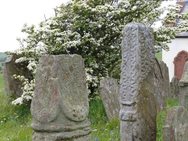
Image: © Milestone Society Taken: Unknown
Beckermet Crosses, in the churchyard, in parish of St Bridget Beckermet (Copeland District), St Bridget's church, by the road to Middlebank Farm. Scheduled Monument. List Entry Number: 1012644 https://historicengland.org.uk/listing/the-list/list-entry/1012644 To be surveyed Milestone Society National ID: CBCL_SBR
Images are licensed for reuse under creativecommons.org/licenses/by-sa/2.0
Image Location
Latitude
54.440234
Longitude
-3.520224