Old Milestone by the B430, north of Oxford Lodge
Introduction
The photograph on this page of Old Milestone by the B430, north of Oxford Lodge by A Rosevear as part of the Geograph project.
The Geograph project started in 2005 with the aim of publishing, organising and preserving representative images for every square kilometre of Great Britain, Ireland and the Isle of Man.

There are currently over 7.5m images from over 14,400 individuals and you can help contribute to the project by visiting https://www.geograph.org.uk
Old Milestone by the B430, north of Oxford Lodge
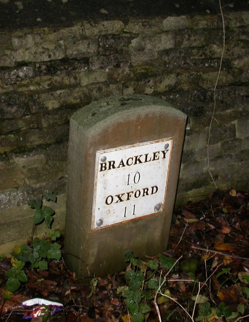
Image: © A Rosevear Taken: 19 Mar 2003
Stone post (plate lost and replaced) by the B430 (was A43), in parish of MIDDLETON STONEY (CHERWELL District), Old Covert, North of Oxford Lodge, against drystone wall of park woodland, on verge lower than road, on West side of road. Brackley tombstone and iron plate, erected by the Towcester, Brackley to Weston turnpike trust in the 19th century. Inscription reads:- BRACKLEY 10 OXFORD 11 Carved benchmark and rivet on top. Milestone Society National ID: OX_OXNH11.
Images are licensed for reuse under creativecommons.org/licenses/by-sa/2.0
Image Location
Latitude
51.895986
Longitude
-1.226531