Old Milestone by the A38, Claypits, Eastington parish
Introduction
The photograph on this page of Old Milestone by the A38, Claypits, Eastington parish by C Minto as part of the Geograph project.
The Geograph project started in 2005 with the aim of publishing, organising and preserving representative images for every square kilometre of Great Britain, Ireland and the Isle of Man.

There are currently over 7.5m images from over 14,400 individuals and you can help contribute to the project by visiting https://www.geograph.org.uk
Old Milestone by the A38, Claypits, Eastington parish
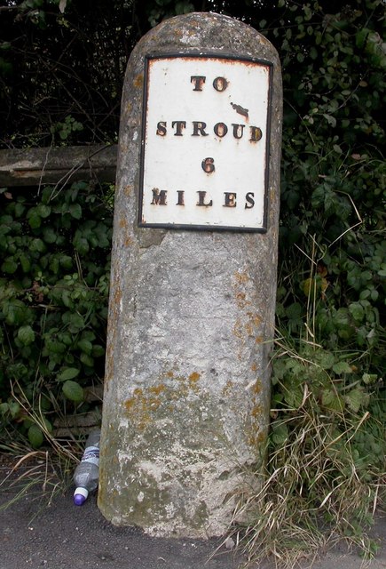
Image: © C Minto Taken: 22 Oct 2007
Metal plate attached to stone post by the A38, in parish of EASTINGTON (STROUD District), Claypits; opposite garage, East corner of junction, by traffic lights. Stroud iron plate, erected by the Cainscross (Division) turnpike trust in the 19th century. Inscription reads:- TO STROUD 6 MILES Grade II listed. List Entry Number: 1090554 https://historicengland.org.uk/listing/the-list/list-entry/1090554 Milestone Society National ID: GL_SDGL06.
Images are licensed for reuse under creativecommons.org/licenses/by-sa/2.0
Image Location
Latitude
51.753264
Longitude
-2.342097