Old Milestone by the A268, Rye Road, Playden
Introduction
The photograph on this page of Old Milestone by the A268, Rye Road, Playden by A Rosevear as part of the Geograph project.
The Geograph project started in 2005 with the aim of publishing, organising and preserving representative images for every square kilometre of Great Britain, Ireland and the Isle of Man.

There are currently over 7.5m images from over 14,400 individuals and you can help contribute to the project by visiting https://www.geograph.org.uk
Old Milestone by the A268, Rye Road, Playden
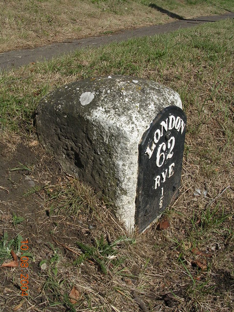
Image: © A Rosevear Taken: 10 Aug 2004
Metal plate attached to stone post by the A268, in parish of PLAYDEN (ROTHER District), Rye Road Hill, opposite Top O' The Hill PH, 25m South of junction with Saltcote Lane, in grass bank between road and path, close to Rye sign, on East side of road. Rye iron plate, erected by the Rye turnpike trust in the 19th century. Inscription reads:- LONDON 62 RYE ½ Milestone Society National ID: SX_LR62.
Images are licensed for reuse under creativecommons.org/licenses/by-sa/2.0
Image Location
Latitude
50.959888
Longitude
0.733771