Old Milestone by the A38, Rattery parish
Introduction
The photograph on this page of Old Milestone by the A38, Rattery parish by Alan Rosevear as part of the Geograph project.
The Geograph project started in 2005 with the aim of publishing, organising and preserving representative images for every square kilometre of Great Britain, Ireland and the Isle of Man.

There are currently over 7.5m images from over 14,400 individuals and you can help contribute to the project by visiting https://www.geograph.org.uk
Old Milestone by the A38, Rattery parish
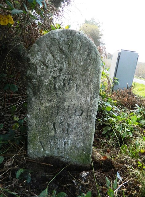
Image: © Alan Rosevear Taken: 17 Nov 2012
Carved stone post by the A38, in parish of RATTERY (SOUTH HAMS District), dual carriageway, South-bound lay-by, half mile East of Marley Head, on grass verge under gorse bush, beside phone, on East side of road. Ashburton tombstone, erected by the Ashburton (Ashburton & Totnes Consolidated) turnpike trust in the 19th century. Inscription reads:- : FROM / Ash- / burton / VI / Miles : : (FROM / Ash- / burton / VI) / Miles : Carved benchmark at base of face. Devon & Dartmoor HER listed. HER Number: MDV47019 https://www.heritagegateway.org.uk/Gateway/Results_Single.aspx?uid=MDV47019&resourceID=104 Milestone Society National ID: DV_PLEX18
Images are licensed for reuse under creativecommons.org/licenses/by-sa/2.0
Image Location
Latitude
50.441086
Longitude
-3.796335