Old Milestone by the A379, New Road, Stoke Fleming
Introduction
The photograph on this page of Old Milestone by the A379, New Road, Stoke Fleming by Alan Rosevear as part of the Geograph project.
The Geograph project started in 2005 with the aim of publishing, organising and preserving representative images for every square kilometre of Great Britain, Ireland and the Isle of Man.

There are currently over 7.5m images from over 14,400 individuals and you can help contribute to the project by visiting https://www.geograph.org.uk
Old Milestone by the A379, New Road, Stoke Fleming
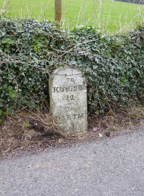
Image: © Alan Rosevear Taken: 22 Feb 2013
Carved stone post by the A379, in parish of STOKE FLEMING (SOUTH HAMS District), 250m East of junction with Old Road into village, past St Peter's Church (150m SSW of Sanders), against wall, by road, on North side of road. Slapton granite marker, erected by the Kingsbridge & Dartmouth turnpike trust in the 19th century. Inscription reads:- TO KINGSBE 12 TO DARTMo 3 Grade II listed. List Entry Number: 1107992 https://historicengland.org.uk/listing/the-list/list-entry/1107992 Milestone Society National ID: DV_KBDM12.
Images are licensed for reuse under creativecommons.org/licenses/by-sa/2.0
Image Location


Leaflet Map data © OpenStreetMap
Latitude
50.320923
Longitude
-3.600159