Old Boundary Marker by the B4427, Frogland Cross
Introduction
The photograph on this page of Old Boundary Marker by the B4427, Frogland Cross by Alan Rosevear as part of the Geograph project.
The Geograph project started in 2005 with the aim of publishing, organising and preserving representative images for every square kilometre of Great Britain, Ireland and the Isle of Man.

There are currently over 7.5m images from over 14,400 individuals and you can help contribute to the project by visiting https://www.geograph.org.uk
Old Boundary Marker by the B4427, Frogland Cross
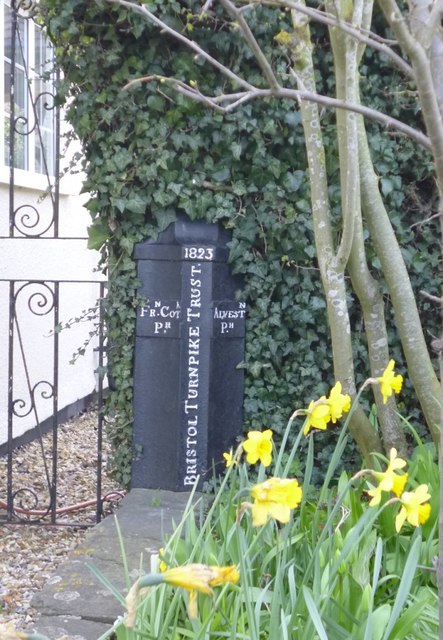
Image: © Alan Rosevear Taken: 19 Mar 2014
Parish Boundary Marker - Turnpike by the B4427, in parish of Frampton Cotterell (South Gloucestershire District), by Turnpike House, Frogland Cross, Old Gloucester Road, Gaunt's Earthcott, beside porch, side gate, and flower bed. Inscription reads:- : FRN.COTL. / PH. : : 1827 / BRISTOL TURNPIKE TRUST. : : ALVESTN. / PH. : South Gloucestershire HER. HER number: 15172 https://www.heritagegateway.org.uk/Gateway/Results_Single.aspx?uid=15172&resourceID=111 Surveyed Milestone Society National ID: GL_BREG08pb
Images are licensed for reuse under creativecommons.org/licenses/by-sa/2.0
Image Location
Latitude
51.55196
Longitude
-2.514118