Old Milestone by Strathmartine Road, Bridgefoot
Introduction
The photograph on this page of Old Milestone by Strathmartine Road, Bridgefoot by Milestone Society as part of the Geograph project.
The Geograph project started in 2005 with the aim of publishing, organising and preserving representative images for every square kilometre of Great Britain, Ireland and the Isle of Man.

There are currently over 7.5m images from over 14,400 individuals and you can help contribute to the project by visiting https://www.geograph.org.uk
Old Milestone by Strathmartine Road, Bridgefoot
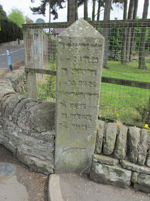
Image: © Milestone Society Taken: Unknown
Stone post by the UC road, in parish of Mains of Strathmartine (Angus District), Bridgefoot, junction with Craigmill Road. Defaced inscription reads:- North Face: Not visible. West Face: TO BALUDERON {<-arrow} 2 MILES TO (??) {<-arrow} 2½ MILES TO DOWNFIELD 1¾ MILES {arrow->} TO DUNDEE (3?) MILES {arrow->} Surveyed Milestone Society National ID: AN_DDAH03bf
Images are licensed for reuse under creativecommons.org/licenses/by-sa/2.0
Image Location


Leaflet Map data © OpenStreetMap
Latitude
56.505642
Longitude
-3.013566