Old Milestone by Mossley Road, Barnsley parish
Introduction
The photograph on this page of Old Milestone by Mossley Road, Barnsley parish by C Minto as part of the Geograph project.
The Geograph project started in 2005 with the aim of publishing, organising and preserving representative images for every square kilometre of Great Britain, Ireland and the Isle of Man.

There are currently over 7.5m images from over 14,400 individuals and you can help contribute to the project by visiting https://www.geograph.org.uk
Old Milestone by Mossley Road, Barnsley parish
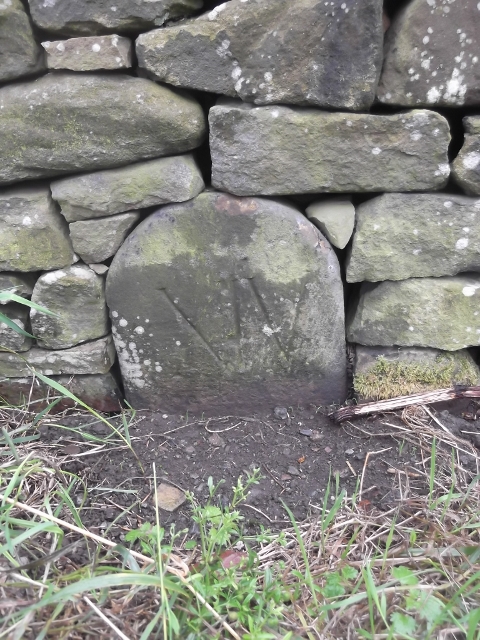
Image: © C Minto Taken: 13 Jul 2002
Carved stone post by the UC road, in parish of BARNSLEY (BARNSLEY District), Mossley Road, in base of wall to left of gateway at west end of Mossley House Farm, on North side of road. Erected by an unknown authority in the 18th century. Inscription reads:- XIV Milestone Society National ID: YS_RMWH14.
Images are licensed for reuse under creativecommons.org/licenses/by-sa/2.0
Image Location


Leaflet Map data © OpenStreetMap
Latitude
53.50484
Longitude
-1.636081