Old Boundary Marker by Oak Lane, Norwich
Introduction
The photograph on this page of Old Boundary Marker by Oak Lane, Norwich by Milestone Society as part of the Geograph project.
The Geograph project started in 2005 with the aim of publishing, organising and preserving representative images for every square kilometre of Great Britain, Ireland and the Isle of Man.

There are currently over 7.5m images from over 14,400 individuals and you can help contribute to the project by visiting https://www.geograph.org.uk
Old Boundary Marker by Oak Lane, Norwich
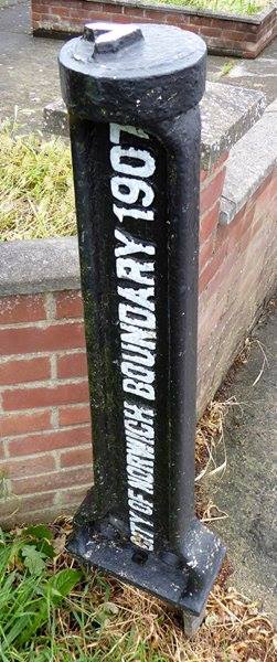
Image: © Milestone Society Taken: Unknown
Municipal Boundary Marker by the UC road, in parish of Norwich (Norwich District), No. 26 Oak Lane, New Sprowston, on verge. Inscription reads vertically:- CITY OF NORWICH BOUNDARY 1907 {arrow on top} Surveyed Milestone Society National ID: NO_NORW01pb
Images are licensed for reuse under creativecommons.org/licenses/by-sa/2.0
Image Location
Latitude
52.653934
Longitude
1.293965