Old Boundary Marker by Chester Road, Penyffordd Institute
Introduction
The photograph on this page of Old Boundary Marker by Chester Road, Penyffordd Institute by John S Turner as part of the Geograph project.
The Geograph project started in 2005 with the aim of publishing, organising and preserving representative images for every square kilometre of Great Britain, Ireland and the Isle of Man.

There are currently over 7.5m images from over 14,400 individuals and you can help contribute to the project by visiting https://www.geograph.org.uk
Old Boundary Marker by Chester Road, Penyffordd Institute
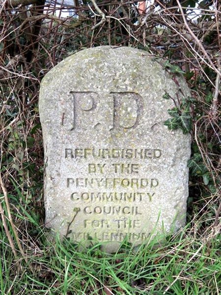
Image: © John S Turner Taken: 18 Feb 2017
Parish Boundary Marker by the UC road, in parish of Penyffordd (Flintshire District), Chester Road. In the hedge by the bus stop, in front of the War Memorial Institute. It's impossible to tell through the chainlink fence and hedge whether there is any inscription remaining on the rear. Inscription reads:- P.D. REFURBISHED BY THE PENYFFORDD COMMUNITY COUNCIL FOR THE MILLENNIUM Surveyed Milestone Society National ID: FLT_PENY01pb
Images are licensed for reuse under creativecommons.org/licenses/by-sa/2.0
Image Location
Latitude
53.14926
Longitude
-3.042953