Old Boundary Markers in Trim Bridge (street), Bath
Introduction
The photograph on this page of Old Boundary Markers in Trim Bridge (street), Bath by Milestone Society as part of the Geograph project.
The Geograph project started in 2005 with the aim of publishing, organising and preserving representative images for every square kilometre of Great Britain, Ireland and the Isle of Man.

There are currently over 7.5m images from over 14,400 individuals and you can help contribute to the project by visiting https://www.geograph.org.uk
Old Boundary Markers in Trim Bridge (street), Bath
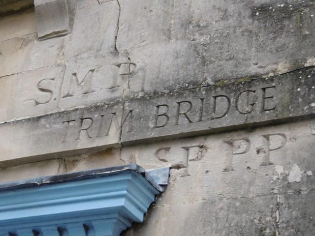
Image: © Milestone Society Taken: Unknown
Parish Boundary Markers by the UC road, in parish of Bath (Bath and North East Somerset District), Southeast corner of Trim Bridge (street), which is actually No 18 Upper Borough Walls, on high fillet. Inscription reads:- S.M.P TRIM BRIDGE S.P.P.P Nos. 18 and 18a Upper Borough Walls are Grade II listed. List Entry Number: 1395443 https://historicengland.org.uk/listing/the-list/list-entry/1395443 Surveyed Milestone Society National ID: SO_BHSMSPP04pb
Images are licensed for reuse under creativecommons.org/licenses/by-sa/2.0
Image Location
Latitude
51.382445
Longitude
-2.361725