Old Boundary Marker by Braxted Park
Introduction
The photograph on this page of Old Boundary Marker by Braxted Park by Milestone Society as part of the Geograph project.
The Geograph project started in 2005 with the aim of publishing, organising and preserving representative images for every square kilometre of Great Britain, Ireland and the Isle of Man.

There are currently over 7.5m images from over 14,400 individuals and you can help contribute to the project by visiting https://www.geograph.org.uk
Old Boundary Marker by Braxted Park
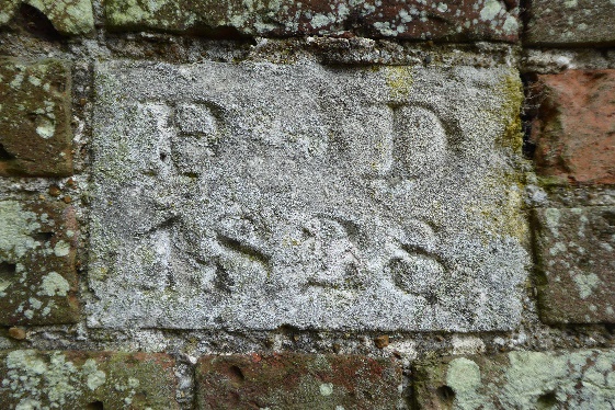
Image: © Milestone Society Taken: Unknown
Estate Boundary Marker by the UC road, in parish of Great Braxted (Maldon District), set into boundary wall of Braxted Park, set into brick wall on left side of gate on Southeast corner of estate. EX_BRAXPK02em is on the right side of the gate: Image Inscription reads:- P D 1828 Boundary wall is Grade II listed. List Entry Number: 1111073 https://historicengland.org.uk/listing/the-list/list-entry/1111073 Surveyed Milestone Society National ID: EX_BRAXPK01em
Images are licensed for reuse under creativecommons.org/licenses/by-sa/2.0
Image Location
Latitude
51.80012
Longitude
0.702887