Old Boundary Marker by the A39, Wells Road, Corston
Introduction
The photograph on this page of Old Boundary Marker by the A39, Wells Road, Corston by Milestone Society as part of the Geograph project.
The Geograph project started in 2005 with the aim of publishing, organising and preserving representative images for every square kilometre of Great Britain, Ireland and the Isle of Man.

There are currently over 7.5m images from over 14,400 individuals and you can help contribute to the project by visiting https://www.geograph.org.uk
Old Boundary Marker by the A39, Wells Road, Corston
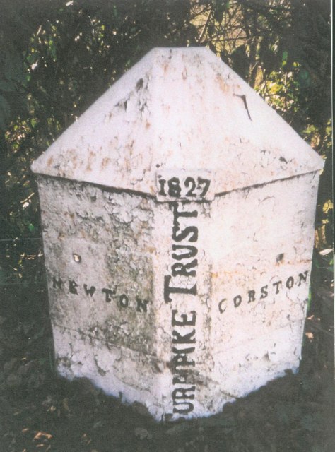
Image: © Milestone Society Taken: Unknown
Parish Boundary Marker - Turnpike by the A39, in parish of Corston (Bath And North East Somerset District), eastern side of Corston Village, on grass verge beside the South side of the road. Inscription reads:- : NEWTON : : 1827 / TURNPIKE TRUST : : CORSTON : Grade II listed. List Entry Number: 1320799 https://historicengland.org.uk/listing/the-list/list-entry/1320799 Surveyed. Milestone Society National ID: SO_BAMK03pb
Images are licensed for reuse under creativecommons.org/licenses/by-sa/2.0
Image Location
Latitude
51.385532
Longitude
-2.437222