Old Wayside Cross - moved to Dawlish churchyard
Introduction
The photograph on this page of Old Wayside Cross - moved to Dawlish churchyard by Alan Rosevear as part of the Geograph project.
The Geograph project started in 2005 with the aim of publishing, organising and preserving representative images for every square kilometre of Great Britain, Ireland and the Isle of Man.

There are currently over 7.5m images from over 14,400 individuals and you can help contribute to the project by visiting https://www.geograph.org.uk
Old Wayside Cross - moved to Dawlish churchyard
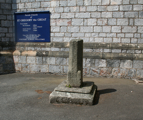
Image: © Alan Rosevear Taken: 11 May 2009
Dawlish Churchyard Cross, old shaft and base, by the path, in parish of Dawlish (Teignbridge District), by the Southeast side of church tower, in tarmac path. Grade II listed. List Entry Number: 1164206 https://historicengland.org.uk/listing/the-list/list-entry/1164206 Surveyed Milestone Society National ID: DVTE_DAW03
Images are licensed for reuse under creativecommons.org/licenses/by-sa/2.0
Image Location


Leaflet Map data © OpenStreetMap
Latitude
50.580065
Longitude
-3.479418