Drywell Wayside Cross by Cross Gate crossroads
Introduction
The photograph on this page of Drywell Wayside Cross by Cross Gate crossroads by Alan Rosevear as part of the Geograph project.
The Geograph project started in 2005 with the aim of publishing, organising and preserving representative images for every square kilometre of Great Britain, Ireland and the Isle of Man.

There are currently over 7.5m images from over 14,400 individuals and you can help contribute to the project by visiting https://www.geograph.org.uk
Drywell Wayside Cross by Cross Gate crossroads
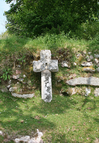
Image: © Alan Rosevear Taken: 25 May 2010
Drywell Cross or Cross Gate Cross, old head and shaft, Starkey No.83 by the UC road, in parish of Widecombe in the Moor (Teignbridge District), Cross Gate crossroads, North of Jordan Manor and 250m South West of Dockwell Farm, against a hedge bank below a large old maple tree. Grade II listed. List Entry Number: 1241515 https://historicengland.org.uk/listing/the-list/list-entry/1241515 Surveyed Milestone Society National ID: DVTE_WID01
Images are licensed for reuse under creativecommons.org/licenses/by-sa/2.0
Image Location
Latitude
50.56318
Longitude
-3.835385