Old Milestone by New Road, Studley, Calne Parish
Introduction
The photograph on this page of Old Milestone by New Road, Studley, Calne Parish by A Rosevear / Jonathan Glew as part of the Geograph project.
The Geograph project started in 2005 with the aim of publishing, organising and preserving representative images for every square kilometre of Great Britain, Ireland and the Isle of Man.

There are currently over 7.5m images from over 14,400 individuals and you can help contribute to the project by visiting https://www.geograph.org.uk
Old Milestone by New Road, Studley, Calne Parish
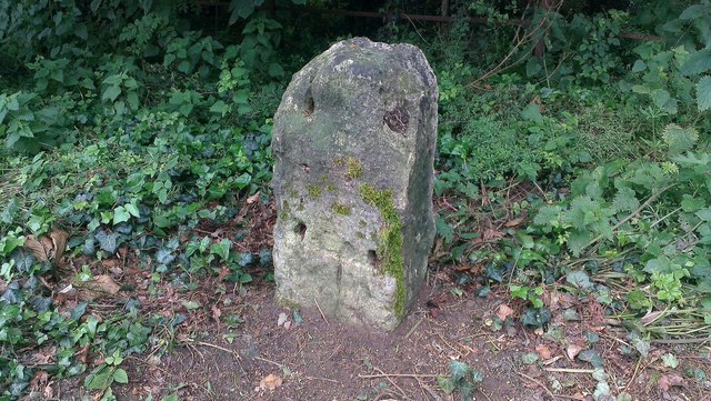
Image: © A Rosevear / Jonathan Glew Taken: 20 Jan 2016
Stone post (plate lost) by the A4, in parish of CALNE (NORTH WILTSHIRE District), New Road, 400m West of junction with Studley Lane, on the verge, on South side of road. Bath limestone with iron plate, erected by the Calne turnpike trust in the 19th century. Inscription reads:- To Bath 16 Rivet benchmark on the top with cut arrow on rear face. Grade II listed. List Entry Number: 1254373 https://historicengland.org.uk/listing/the-list/list-entry/1254373 Milestone Society National ID: WI_LB_BACN16.
Images are licensed for reuse under creativecommons.org/licenses/by-sa/2.0
Image Location
Latitude
51.43862
Longitude
-2.058506