Old Boundary Marker by the A19, Birdforth Bridge
Introduction
The photograph on this page of Old Boundary Marker by the A19, Birdforth Bridge by Milestone Society as part of the Geograph project.
The Geograph project started in 2005 with the aim of publishing, organising and preserving representative images for every square kilometre of Great Britain, Ireland and the Isle of Man.

There are currently over 7.5m images from over 14,400 individuals and you can help contribute to the project by visiting https://www.geograph.org.uk
Old Boundary Marker by the A19, Birdforth Bridge
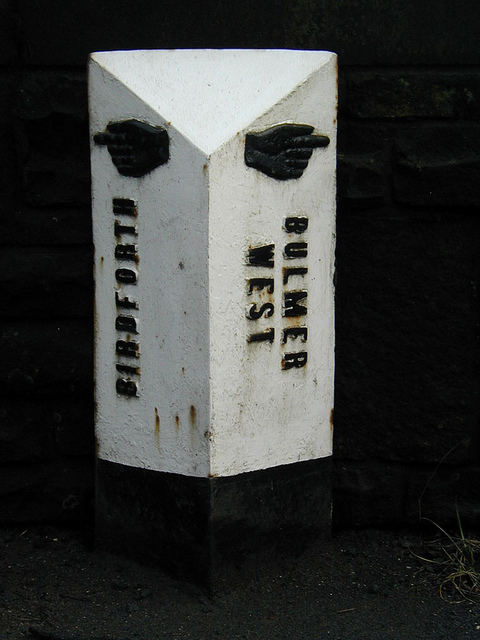
Image: © Milestone Society Taken: Unknown
Parish Boundary Marker by the A19, in parish of Birdforth (Hambleton District), Centre of Birdforth Bridge, over Birdforth Beck, on East side of bridge. Inscription reads:- : {pointing hand} / BIRDFORTH : : {pointing hand} / BULMER / WEST : Grade II listed. List Entry Number: 1150721 https://historicengland.org.uk/listing/the-list/list-entry/1150721 N.B.Listed as a 'Milestone' Surveyed Milestone Society National ID: YN_BIRD01pb
Images are licensed for reuse under creativecommons.org/licenses/by-sa/2.0
Image Location


Leaflet Map data © OpenStreetMap
Latitude
54.174774
Longitude
-1.256415