Old Bridge Marker by Mount Pleasant, Chudleigh
Introduction
The photograph on this page of Old Bridge Marker by Mount Pleasant, Chudleigh by Alan Rosevear as part of the Geograph project.
The Geograph project started in 2005 with the aim of publishing, organising and preserving representative images for every square kilometre of Great Britain, Ireland and the Isle of Man.

There are currently over 7.5m images from over 14,400 individuals and you can help contribute to the project by visiting https://www.geograph.org.uk
Old Bridge Marker by Mount Pleasant, Chudleigh
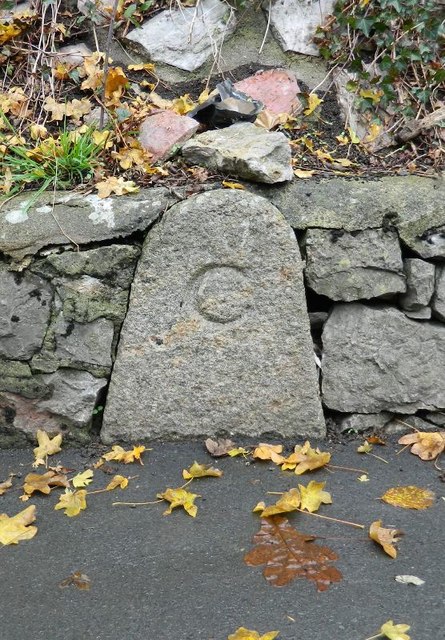
Image: © Alan Rosevear Taken: 17 Nov 2012
Bridge Marker by the UC road, in parish of Chudleigh (Teignbridge District), 80 metres northeast of Bridgeland Bridge, Kate Brook, low down in a stone wall on the northeast side of the junction of Mount Pleasant and Lears Lane. See https://www.geograph.org.uk/photo/7546279 for a more recent photo. Surveyed Milestone Society National ID: DV_CHAC01Abr
Images are licensed for reuse under creativecommons.org/licenses/by-sa/2.0
Image Location
Latitude
50.60253
Longitude
-3.595265