Frozen flood basin at New Lubbesthorpe
Introduction
The photograph on this page of Frozen flood basin at New Lubbesthorpe by Mat Fascione as part of the Geograph project.
The Geograph project started in 2005 with the aim of publishing, organising and preserving representative images for every square kilometre of Great Britain, Ireland and the Isle of Man.

There are currently over 7.5m images from over 14,400 individuals and you can help contribute to the project by visiting https://www.geograph.org.uk
Frozen flood basin at New Lubbesthorpe
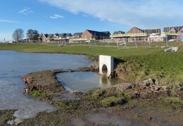
Image: © Mat Fascione Taken: 3 Feb 2019
This is the site of the New Lubbesthorpe housing development, 4,250 homes will be built on a site that lies to the west of the M1, east of Beggar’s Lane, south of Leicester Forest East and north and south of the M69. This is one of the first areas to be developed known as Hereswode.
Images are licensed for reuse under creativecommons.org/licenses/by-sa/2.0
Image Location
Latitude
52.612413
Longitude
-1.222538