Old Milestone by the A647, Scarlet Heights, Bradford
Introduction
The photograph on this page of Old Milestone by the A647, Scarlet Heights, Bradford by C Minto as part of the Geograph project.
The Geograph project started in 2005 with the aim of publishing, organising and preserving representative images for every square kilometre of Great Britain, Ireland and the Isle of Man.

There are currently over 7.5m images from over 14,400 individuals and you can help contribute to the project by visiting https://www.geograph.org.uk
Old Milestone by the A647, Scarlet Heights, Bradford
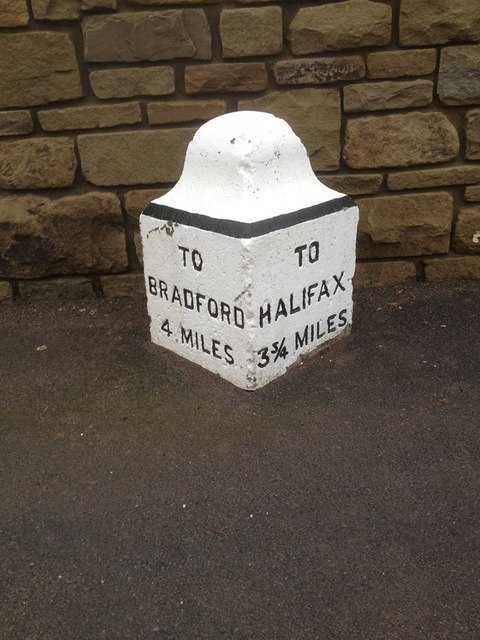
Image: © C Minto Taken: Unknown
Carved stone post by the A647, in parish of BRADFORD (BRADFORD District), Scarlet Heights, quarter mile East of A644 crossroads; opposite Rock Lea, in front of new stone wall, between lampposts 129 and 130, on North side of road. Previously on top of old low stone wall. Erected by the Leeds & Halifax turnpike wall trust in the 18th century. Inscription reads:- : TO / BRADFORD / 4 MILES : : TO / HALIFAX / 3¾ MILES : Grade II Listed. List Entry Number: 1133590 https://historicengland.org.uk/listing/the-list/list-entry/1133590 Milestone Society National ID: YW_HABF04.
Images are licensed for reuse under creativecommons.org/licenses/by-sa/2.0
Image Location
Latitude
53.769816
Longitude
-1.838097