Old Boundary Marker by Selkirk Road, Tooting Graveney
Introduction
The photograph on this page of Old Boundary Marker by Selkirk Road, Tooting Graveney by Milestone Society as part of the Geograph project.
The Geograph project started in 2005 with the aim of publishing, organising and preserving representative images for every square kilometre of Great Britain, Ireland and the Isle of Man.

There are currently over 7.5m images from over 14,400 individuals and you can help contribute to the project by visiting https://www.geograph.org.uk
Old Boundary Marker by Selkirk Road, Tooting Graveney
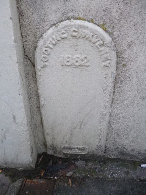
Image: © Milestone Society Taken: Unknown
Parish Boundary Marker by the UC road, in parish of Tooting (Wandsworth District), Selkirk Road SW17, partially inset into garden wall of No 22, North East side of road. Inscription reads:- : TOOTING GRAVENEY / 1882 / {maker's name} : Surveyed Milestone Society National ID: SY_TOOT02pb
Images are licensed for reuse under creativecommons.org/licenses/by-sa/2.0
Image Location
Latitude
51.429659
Longitude
-0.167688