Old Milestone by the A419,
Introduction
The photograph on this page of Old Milestone by the A419, by JM Weightmann as part of the Geograph project.
The Geograph project started in 2005 with the aim of publishing, organising and preserving representative images for every square kilometre of Great Britain, Ireland and the Isle of Man.

There are currently over 7.5m images from over 14,400 individuals and you can help contribute to the project by visiting https://www.geograph.org.uk
Old Milestone by the A419,
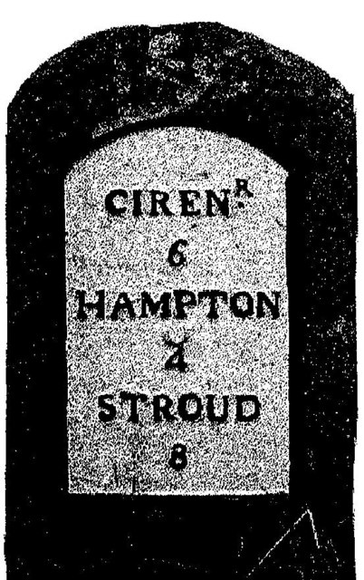
Image: © JM Weightmann Taken: 1 Nov 1999
Metal plate attached to stone post by the A419, in parish of SAPPERTON (COTSWOLD District), East of Beacon Farm; 20 yds West of field gate, by the road, on South side of road. Cirencester roundhead iron plate, erected by the Cirencester to Stroud turnpike trust in the 19th century. For a later photo see: Image Inscription reads:- CIREN.R 6 HAMPTON 4 STROUD 8 Grade II Listed. List Entry Number: 1341176 https://historicengland.org.uk/listing/the-list/list-entry/1341176 Milestone Society National ID: GL_CISD06.
Images are licensed for reuse under creativecommons.org/licenses/by-sa/2.0
Image Location
Latitude
51.71485
Longitude
-2.101012