Old Boundary Marker by High Street, Southend on Sea
Introduction
The photograph on this page of Old Boundary Marker by High Street, Southend on Sea by Milestone Society as part of the Geograph project.
The Geograph project started in 2005 with the aim of publishing, organising and preserving representative images for every square kilometre of Great Britain, Ireland and the Isle of Man.

There are currently over 7.5m images from over 14,400 individuals and you can help contribute to the project by visiting https://www.geograph.org.uk
Old Boundary Marker by High Street, Southend on Sea
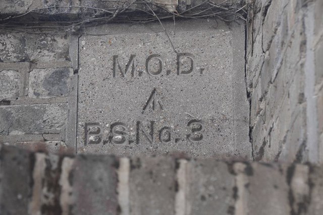
Image: © Milestone Society Taken: Unknown
Estate Boundary Marker - MOD #3 by the UC road, in parish of Southend on Sea (Southend on Sea District), High Street, on left hand gate pillar at entrance to former barracks, to the left of: EX_MODSHO03Aem Image Surveyed Milestone Society National ID: EX_MODSHO03em
Images are licensed for reuse under creativecommons.org/licenses/by-sa/2.0
Image Location
Latitude
51.528721
Longitude
0.794644