Old Milestone by the former A66, Woodend Farm
Introduction
The photograph on this page of Old Milestone by the former A66, Woodend Farm by GG Farrington as part of the Geograph project.
The Geograph project started in 2005 with the aim of publishing, organising and preserving representative images for every square kilometre of Great Britain, Ireland and the Isle of Man.

There are currently over 7.5m images from over 14,400 individuals and you can help contribute to the project by visiting https://www.geograph.org.uk
Old Milestone by the former A66, Woodend Farm
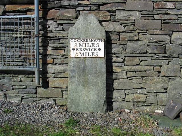
Image: © GG Farrington Taken: 3 Mar 2007
Metal plate attached to stone post by the UC road (was A66), in parish of ABOVE DERWENT (ALLERDALE District), was by road North of Wood End Farm, now near gate on private land against farm building, visible from road. Cockermouth plate, erected by the Keswick turnpike trust in the 19th century. Original Grid Reference approximately: NY 2185 2745 on East side of road. Inscription reads:- : COCKERMOUTH / 8 MILES / KESWICK / 5 MILES : Milestone Society National ID: CU_CMKW08.
Images are licensed for reuse under creativecommons.org/licenses/by-sa/2.0
Image Location
Latitude
54.634396
Longitude
-3.211447