Old Bridge Marker by the A1095, Mights Bridge, Southwold
Introduction
The photograph on this page of Old Bridge Marker by the A1095, Mights Bridge, Southwold by Milestone Society as part of the Geograph project.
The Geograph project started in 2005 with the aim of publishing, organising and preserving representative images for every square kilometre of Great Britain, Ireland and the Isle of Man.

There are currently over 7.5m images from over 14,400 individuals and you can help contribute to the project by visiting https://www.geograph.org.uk
Old Bridge Marker by the A1095, Mights Bridge, Southwold
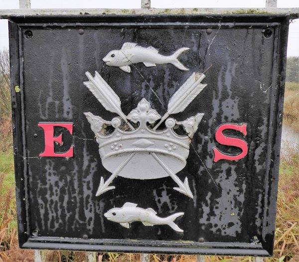
Image: © Milestone Society Taken: Unknown
Bridge Marker by the A1095, in parish of Southwold (Waveney District), Mights Bridge over Buss Creek, on bridge pier and centre points of parapets, West side of road. Surveyed Milestone Society National ID: SU_SOUREY01br
Images are licensed for reuse under creativecommons.org/licenses/by-sa/2.0
Image Location
Latitude
52.332982
Longitude
1.674185