Old Boundary Marker by the B3174, Jack-in-the-Green, Rockbeare Parish
Introduction
The photograph on this page of Old Boundary Marker by the B3174, Jack-in-the-Green, Rockbeare Parish by Alan Rosevear as part of the Geograph project.
The Geograph project started in 2005 with the aim of publishing, organising and preserving representative images for every square kilometre of Great Britain, Ireland and the Isle of Man.

There are currently over 7.5m images from over 14,400 individuals and you can help contribute to the project by visiting https://www.geograph.org.uk
Old Boundary Marker by the B3174, Jack-in-the-Green, Rockbeare Parish
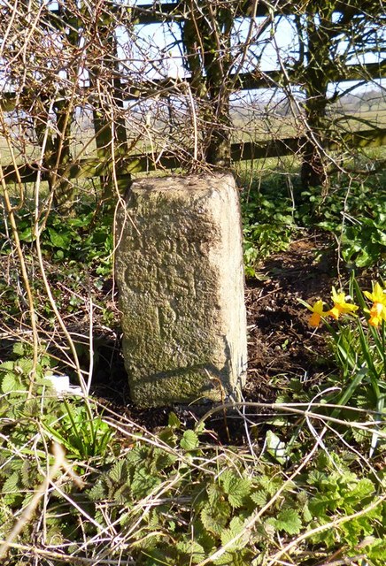
Image: © Alan Rosevear Taken: 3 Apr 2013
Parish Boundary Marker by the B3174 (was A30), in parish of Rockbeare (East Devon District), 100m East of Murco garage, just East of the junction at Stone Cottage, at back of wide grass verge in the new hedge. Surveyed Milestone Society National ID: DV_HNEX09pb
Images are licensed for reuse under creativecommons.org/licenses/by-sa/2.0
Image Location
Latitude
50.749922
Longitude
-3.397091