Old Milestone by the former A5, Nesscliffe
Introduction
The photograph on this page of Old Milestone by the former A5, Nesscliffe by A Reade/J Higgins as part of the Geograph project.
The Geograph project started in 2005 with the aim of publishing, organising and preserving representative images for every square kilometre of Great Britain, Ireland and the Isle of Man.

There are currently over 7.5m images from over 14,400 individuals and you can help contribute to the project by visiting https://www.geograph.org.uk
Old Milestone by the former A5, Nesscliffe
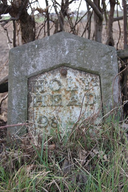
Image: © A Reade/J Higgins Taken: 8 Jul 2008
Metal plate attached to stone post by the UC road (was A5), in parish of GREAT NESS (SHREWSBURY AND ATCHAM District), 30m South East of the junction between the A5 and Well Lane, Nesscliffe, by North end of bus stop layby, on verge, by large tree, on South West side of road. Telford gabled iron plate, erected by the Holyhead Road turnpike trust in the 19th century. Inscription reads:- HOLY- HEAD 98 - M SALOP 8M-6F Grade II Listed. List Entry Number: 1175339 https://historicengland.org.uk/listing/the-list/list-entry/1175339 Milestone Society National ID: SA_HH098.
Images are licensed for reuse under creativecommons.org/licenses/by-sa/2.0
Image Location
Latitude
52.770994
Longitude
-2.919011