Old Guide Stone by the B730, Montgomerie Street, Tarbolton
Introduction
The photograph on this page of Old Guide Stone by the B730, Montgomerie Street, Tarbolton by Milestone Society as part of the Geograph project.
The Geograph project started in 2005 with the aim of publishing, organising and preserving representative images for every square kilometre of Great Britain, Ireland and the Isle of Man.

There are currently over 7.5m images from over 14,400 individuals and you can help contribute to the project by visiting https://www.geograph.org.uk
Old Guide Stone by the B730, Montgomerie Street, Tarbolton
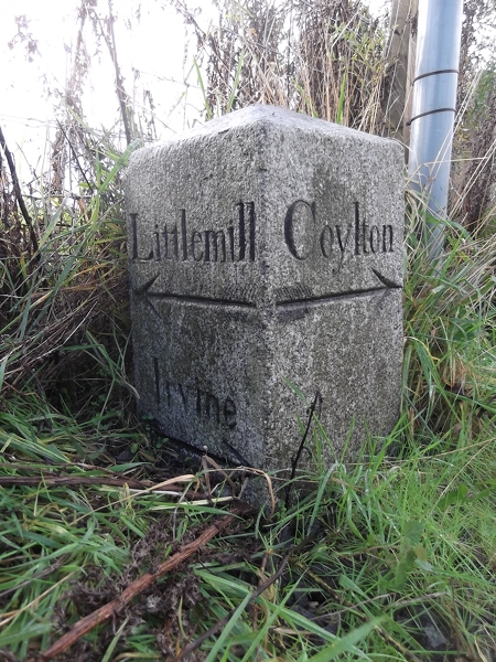
Image: © Milestone Society Taken: Unknown
Square granite by the B730, in parish of Tarbolton (Carrick District), South end of Tarbolton, South West corner of the B730/B744 junction, near milestone: AYS_IRLM12 Image Inscription reads:- : Littlemill / {arrow} / Irvine / {arrow} : : Coylton / {arrow} : Surveyed Milestone Society National ID: AYS_IRLMtb
Images are licensed for reuse under creativecommons.org/licenses/by-sa/2.0
Image Location
Latitude
55.50965
Longitude
-4.483585