Old Milestone by the A365, Bath Road, Seend Parish
Introduction
The photograph on this page of Old Milestone by the A365, Bath Road, Seend Parish by M Faherty as part of the Geograph project.
The Geograph project started in 2005 with the aim of publishing, organising and preserving representative images for every square kilometre of Great Britain, Ireland and the Isle of Man.

There are currently over 7.5m images from over 14,400 individuals and you can help contribute to the project by visiting https://www.geograph.org.uk
Old Milestone by the A365, Bath Road, Seend Parish
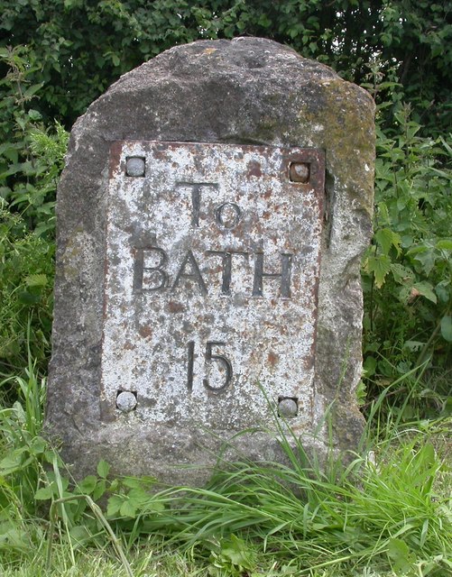
Image: © M Faherty Taken: 8 Jun 2007
Metal plate attached to stone post by the A365, in parish of SEEND (KENNET District), Bath Road, 50m West of Brookes Farm (previously Mitchell Farmhouse), on wide verge (cut) between road and shallow ditch and hedge, on South side of road. Bath incised iron plate, erected by the Melksham turnpike trust in the 19th century. Inscription reads:- To BATH 15 Carved benchmark on mid right side. Grade II Listed. List Entry Number: 1243486 https://historicengland.org.uk/listing/the-list/list-entry/1243486 Milestone Society National ID: WI_LB_BADZ15.
Images are licensed for reuse under creativecommons.org/licenses/by-sa/2.0
Image Location
Latitude
51.358899
Longitude
-2.088937