Old Milestone south west of Pont Tal-y-bont, Ceredigion
Introduction
The photograph on this page of Old Milestone south west of Pont Tal-y-bont, Ceredigion by Milestone Society as part of the Geograph project.
The Geograph project started in 2005 with the aim of publishing, organising and preserving representative images for every square kilometre of Great Britain, Ireland and the Isle of Man.

There are currently over 7.5m images from over 14,400 individuals and you can help contribute to the project by visiting https://www.geograph.org.uk
Old Milestone south west of Pont Tal-y-bont, Ceredigion
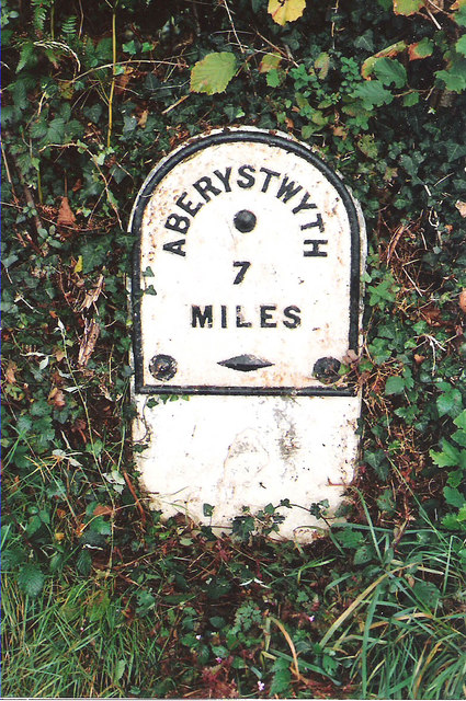
Image: © Milestone Society Taken: Unknown
Aberystwyth plate by the A487, in parish of Ceulanamaesmawr (Ceredigion District), South of Talybont some 350m South of Talybont Square, in bank, North side of road. Inscription reads:- ABERYSTWYTH 7 MILES Grade II listed by Cadw. Reference Number 18897: https://cadwpublic-api.azurewebsites.net/reports/listedbuilding/FullReport?lang=&id=18897 Surveyed Milestone Society National ID: CRD_AYMC07
Images are licensed for reuse under creativecommons.org/licenses/by-sa/2.0
Image Location
Latitude
52.481716
Longitude
-3.986078