Old Milestone by the A25, High Street, Westerham Parish
Introduction
The photograph on this page of Old Milestone by the A25, High Street, Westerham Parish by C Woodward as part of the Geograph project.
The Geograph project started in 2005 with the aim of publishing, organising and preserving representative images for every square kilometre of Great Britain, Ireland and the Isle of Man.

There are currently over 7.5m images from over 14,400 individuals and you can help contribute to the project by visiting https://www.geograph.org.uk
Old Milestone by the A25, High Street, Westerham Parish
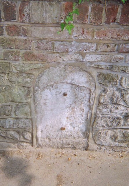
Image: © C Woodward Taken: 30 Apr 2007
Stone post (plate lost) by the A25, in parish of WESTERHAM (SEVENOAKS District), High Street, opposite Nos 2 - 4, near junction with Wells Place, set in wall by letterbox, on South side of road. Wrotham iron plate, erected by the Wrotham Heath turnpike trust in the 19th century. Inscription once read:- : (MAIDSTONE / 21 / GODSTONE / 7½) : Milestone Society National ID: KE_MDGS21.
Images are licensed for reuse under creativecommons.org/licenses/by-sa/2.0
Image Location
Latitude
51.266154
Longitude
0.068703