Old Boundary Marker by Dagnets Lane, Black Notley Parish
Introduction
The photograph on this page of Old Boundary Marker by Dagnets Lane, Black Notley Parish by Milestone Society as part of the Geograph project.
The Geograph project started in 2005 with the aim of publishing, organising and preserving representative images for every square kilometre of Great Britain, Ireland and the Isle of Man.

There are currently over 7.5m images from over 14,400 individuals and you can help contribute to the project by visiting https://www.geograph.org.uk
Old Boundary Marker by Dagnets Lane, Black Notley Parish
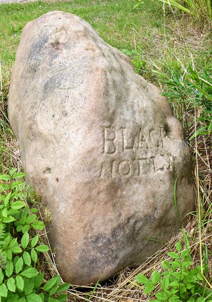
Image: © Milestone Society Taken: Unknown
Parish Boundary Marker by the UC road, in parish of Black Notley (Braintree District), Dagnets Lane, at junction of track to Friars Farm. Grade II listed. List Entry Number: 1147176 https://historicengland.org.uk/listing/the-list/list-entry/1147176 Surveyed Milestone Society National ID: EX_NOTL01pb
Images are licensed for reuse under creativecommons.org/licenses/by-sa/2.0
Image Location


Leaflet Map data © OpenStreetMap
Latitude
51.848656
Longitude
0.528729