Old Boundary Marker by Riverside Leisure Centre, North Meols Parish
Introduction
The photograph on this page of Old Boundary Marker by Riverside Leisure Centre, North Meols Parish by Milestone Society as part of the Geograph project.
The Geograph project started in 2005 with the aim of publishing, organising and preserving representative images for every square kilometre of Great Britain, Ireland and the Isle of Man.

There are currently over 7.5m images from over 14,400 individuals and you can help contribute to the project by visiting https://www.geograph.org.uk
Old Boundary Marker by Riverside Leisure Centre, North Meols Parish
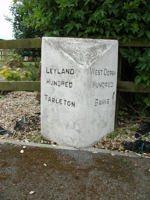
Image: © Milestone Society Taken: Unknown
Parish Boundary Marker off the A565, in parish of North Meols (West Lancashire District), Southport New Road, Mere Brow, Riverside Holiday Park, Gravel Lane, 100m from main road. Surveyed Milestone Society National ID: LA_BANTAR01pb
Images are licensed for reuse under creativecommons.org/licenses/by-sa/2.0
Image Location
Latitude
53.667204
Longitude
-2.902563