Old Boundary Marker by the A3216, Queenstown Road, Battersea Parish
Introduction
The photograph on this page of Old Boundary Marker by the A3216, Queenstown Road, Battersea Parish by Milestone Society as part of the Geograph project.
The Geograph project started in 2005 with the aim of publishing, organising and preserving representative images for every square kilometre of Great Britain, Ireland and the Isle of Man.

There are currently over 7.5m images from over 14,400 individuals and you can help contribute to the project by visiting https://www.geograph.org.uk
Old Boundary Marker by the A3216, Queenstown Road, Battersea Parish
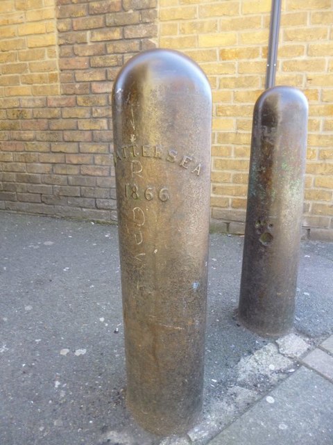
Image: © Milestone Society Taken: Unknown
Parish Boundary Marker by the A3216, in parish of Battersea (Wandsworth District), Queenstown Road SW8, at entrance to housing development in pavement next to Clapham post: SY_CLAP06pb Image Inscription reads:- BATTERSEA 1866 Surveyed Milestone Society National ID: SY_BATT22pb
Images are licensed for reuse under creativecommons.org/licenses/by-sa/2.0
Image Location
Latitude
51.467365
Longitude
-0.150528