Old Guide Stoneby Honeywell Lane, Ilsington Parish
Introduction
The photograph on this page of Old Guide Stoneby Honeywell Lane, Ilsington Parish by Alan Rosevear as part of the Geograph project.
The Geograph project started in 2005 with the aim of publishing, organising and preserving representative images for every square kilometre of Great Britain, Ireland and the Isle of Man.

There are currently over 7.5m images from over 14,400 individuals and you can help contribute to the project by visiting https://www.geograph.org.uk
Old Guide Stoneby Honeywell Lane, Ilsington Parish
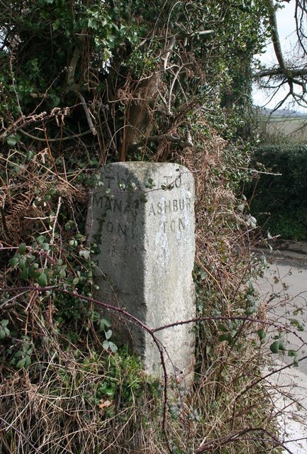
Image: © Alan Rosevear Taken: 7 Mar 2012
Dartmoor granite guidepost by the UC road, in parish of Ilsington (Teignbridge District), T-junction with Honeywell Lane, at lower end of Playing Fields at corner of lane from Ilsington Methodist Church to Lewthorn crossroads, on grass verge in hedge under holly. Inscription reads:- : TO / MANA / TON : : TO / ASHBUR / TON : Grade II listed. List Entry Number: 1260939 https://historicengland.org.uk/listing/the-list/list-entry/1260939 Surveyed Milestone Society National ID: DV_XILS03
Images are licensed for reuse under creativecommons.org/licenses/by-sa/2.0
Image Location
Latitude
50.56942
Longitude
-3.72552