Old Milepost by the B833, Shore Road, Rosneath, Rosneath Parish
Introduction
The photograph on this page of Old Milepost by the B833, Shore Road, Rosneath, Rosneath Parish by Milestone Society as part of the Geograph project.
The Geograph project started in 2005 with the aim of publishing, organising and preserving representative images for every square kilometre of Great Britain, Ireland and the Isle of Man.

There are currently over 7.5m images from over 14,400 individuals and you can help contribute to the project by visiting https://www.geograph.org.uk
Old Milepost by the B833, Shore Road, Rosneath, Rosneath Parish
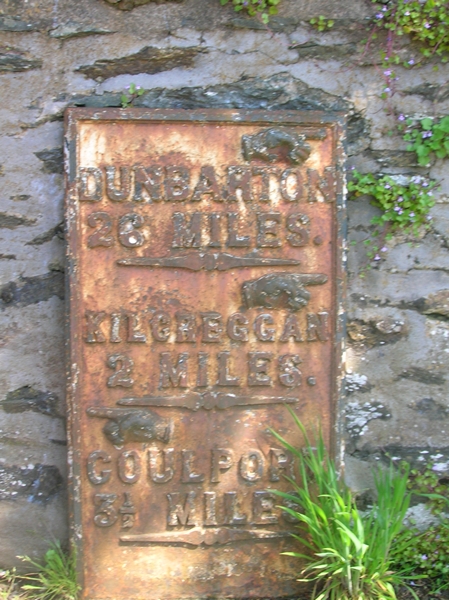
Image: © Milestone Society Taken: Unknown
Dunbarton plate by the B833, in parish of Rosneath (Argyll and Bute District), Cove, near entrance to Caris, just North of bus stop. Inscription reads:- : {pointing hand} / DUNBARTON / 26 MILES / {pointing hand} / KILCREGGAN / 2 MILES / {pointing hand} / COULPORT / 3½ MILES : Surveyed Milestone Society National ID: AB_GLCP10
Images are licensed for reuse under creativecommons.org/licenses/by-sa/2.0
Image Location
Latitude
56.002038
Longitude
-4.852273