Old Direction Sign - Signpost by Tresooth, Penwarne Road, Budock Parish
Introduction
The photograph on this page of Old Direction Sign - Signpost by Tresooth, Penwarne Road, Budock Parish by Milestone Society as part of the Geograph project.
The Geograph project started in 2005 with the aim of publishing, organising and preserving representative images for every square kilometre of Great Britain, Ireland and the Isle of Man.

There are currently over 7.5m images from over 14,400 individuals and you can help contribute to the project by visiting https://www.geograph.org.uk
Old Direction Sign - Signpost by Tresooth, Penwarne Road, Budock Parish
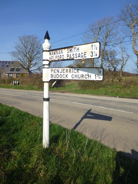
Image: © Milestone Society Taken: Unknown
Raised finial - G; by the UC road, in parish of Budock (Kerrier District), Tresooth, opposite turn to Penjerrick Garden - Penwarne Road junction with No Mans' Land Road, on open verge, 1m from road edge. To be surveyed Milestone Society National ID: CW_SW7731
Images are licensed for reuse under creativecommons.org/licenses/by-sa/2.0
Image Location
Latitude
50.138261
Longitude
-5.120697