Old Boundary Marker by the A6024, Woodhead Road, Holme Valley Parish
Introduction
The photograph on this page of Old Boundary Marker by the A6024, Woodhead Road, Holme Valley Parish by M Bardell as part of the Geograph project.
The Geograph project started in 2005 with the aim of publishing, organising and preserving representative images for every square kilometre of Great Britain, Ireland and the Isle of Man.

There are currently over 7.5m images from over 14,400 individuals and you can help contribute to the project by visiting https://www.geograph.org.uk
Old Boundary Marker by the A6024, Woodhead Road, Holme Valley Parish
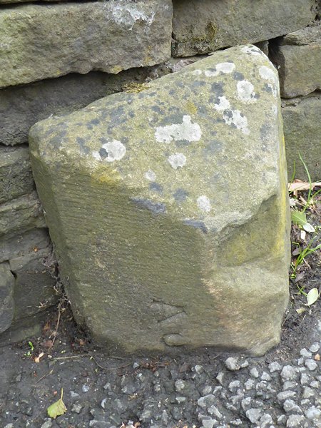
Image: © M Bardell Taken: 19 Jul 2017
Parish Boundary Marker by the A6024, in parish of Holme Valley (Kirklees District), Woodhead Road, Holmbridge, against stone wall. Inscribed AUSTONLEY AND HOLME on adjacent faces Surveyed Milestone Society National ID: YW_AUSHOL02pb
Images are licensed for reuse under creativecommons.org/licenses/by-sa/2.0
Image Location
Latitude
53.555758
Longitude
-1.82166