Old Boundary Marker by Cormont Road, Camberwell and Dulwich Parish
Introduction
The photograph on this page of Old Boundary Marker by Cormont Road, Camberwell and Dulwich Parish by Milestone Society as part of the Geograph project.
The Geograph project started in 2005 with the aim of publishing, organising and preserving representative images for every square kilometre of Great Britain, Ireland and the Isle of Man.

There are currently over 7.5m images from over 14,400 individuals and you can help contribute to the project by visiting https://www.geograph.org.uk
Old Boundary Marker by Cormont Road, Camberwell and Dulwich Parish
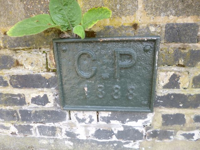
Image: © Milestone Society Taken: Unknown
Parish Boundary Marker by the UC road, in parish of Camberwell and Dulwich (Southwark District), Cormont Road SE5, on low wall of Myatt's Fields Park, opposite Stannard Hall flats. Surveyed Milestone Society National ID: SY_SGC20pb
Images are licensed for reuse under creativecommons.org/licenses/by-sa/2.0
Image Location
Latitude
51.474095
Longitude
-0.105127