Old Boundary Marker in Shipley, north of Bradford
Introduction
The photograph on this page of Old Boundary Marker in Shipley, north of Bradford by Milestone Society as part of the Geograph project.
The Geograph project started in 2005 with the aim of publishing, organising and preserving representative images for every square kilometre of Great Britain, Ireland and the Isle of Man.

There are currently over 7.5m images from over 14,400 individuals and you can help contribute to the project by visiting https://www.geograph.org.uk
Old Boundary Marker in Shipley, north of Bradford
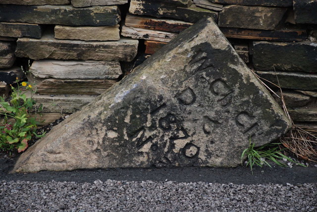
Image: © Milestone Society Taken: Unknown
Ecclesiastical Boundary Marker by the UC road, in parish of Bradford (Bradford District), Thackley, junction of Thackley Old Road and Windhill Old Road, in road against stone wall and vulnerable to being hit, on North side of road. Inscription reads:- : W Ch Ch D C / 1870 / No 3 : Thanks for this information provided by Richard Heywood: "Windhill Christ Church District Chapelry. This new church was established in 1870, hence the date, and the item in the London Gazette authorising it and defining the boundaries of the chapelry indicates that there were originally (and still could be) five such boundary stones, numbered 1-5." Milestone Society National ID: YW_BRAD04pb
Images are licensed for reuse under creativecommons.org/licenses/by-sa/2.0
Image Location
Latitude
53.840599
Longitude
-1.750577