Ruined, Brunswick Cemetery, Bristol
Introduction
The photograph on this page of Ruined, Brunswick Cemetery, Bristol by Derek Harper as part of the Geograph project.
The Geograph project started in 2005 with the aim of publishing, organising and preserving representative images for every square kilometre of Great Britain, Ireland and the Isle of Man.

There are currently over 7.5m images from over 14,400 individuals and you can help contribute to the project by visiting https://www.geograph.org.uk
Ruined, Brunswick Cemetery, Bristol
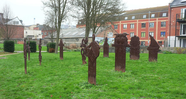
Image: © Derek Harper Taken: 5 Jan 2019
Ruined (2010), by Hew Locke, is a series of "cast iron grave markers which have been fabricated using the artist’s original designs and relate to the share certificates and historical documents of commercial companies, which no longer exist or have undergone transformation" http://www.aprb.co.uk/projects/all-projects/2010/ruined-hew-locke-brunswick-cemetery . "Brunswick Cemetery was established around 1770 and later, it became a Unitarian burial ground until 1963 when it became a public park." In the background is housing and a garage on Wilder Street. I shall try to return on a sunny day for another look.
Images are licensed for reuse under creativecommons.org/licenses/by-sa/2.0
Image Location
Latitude
51.461069
Longitude
-2.587656