Graveyard at Quarrington Hill
Introduction
The photograph on this page of Graveyard at Quarrington Hill by Trevor Littlewood as part of the Geograph project.
The Geograph project started in 2005 with the aim of publishing, organising and preserving representative images for every square kilometre of Great Britain, Ireland and the Isle of Man.

There are currently over 7.5m images from over 14,400 individuals and you can help contribute to the project by visiting https://www.geograph.org.uk
Graveyard at Quarrington Hill
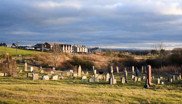
Image: © Trevor Littlewood Taken: 30 Jan 2019
The graveyard at Quarrington Hill is in what were the surroundings of St. Paul's Church which was demolished due to mining subsidence; the image was recorded from the original position of the church. Buildings at the northern end of the village are in view.
Images are licensed for reuse under creativecommons.org/licenses/by-sa/2.0
Image Location
Latitude
54.734697
Longitude
-1.481267