Old Milestone by the B4068, Lower Swell, Swell Parish
Introduction
The photograph on this page of Old Milestone by the B4068, Lower Swell, Swell Parish by J Stanbridge as part of the Geograph project.
The Geograph project started in 2005 with the aim of publishing, organising and preserving representative images for every square kilometre of Great Britain, Ireland and the Isle of Man.

There are currently over 7.5m images from over 14,400 individuals and you can help contribute to the project by visiting https://www.geograph.org.uk
Old Milestone by the B4068, Lower Swell, Swell Parish
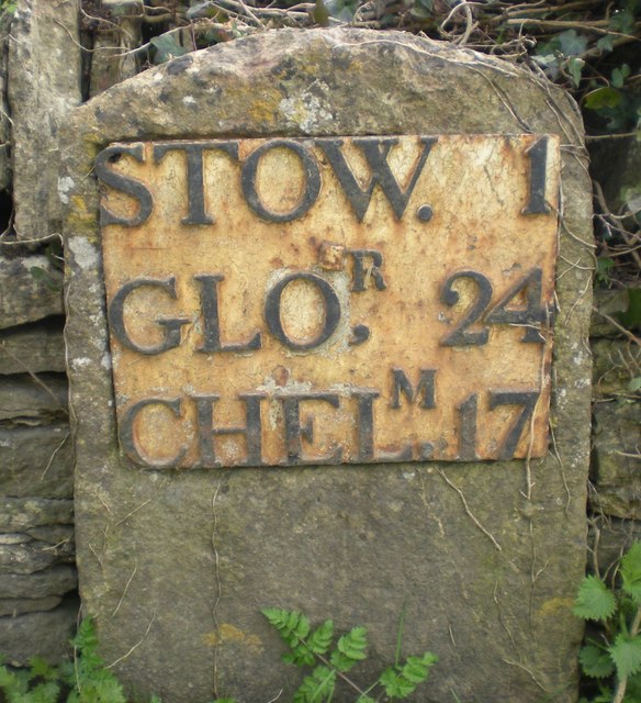
Image: © J Stanbridge Taken: 11 Apr 2010
Metal plate attached to stone post by the B4068, in parish of SWELL (COTSWOLD District), Lower Swell; opposite Old Farmhouse Hotel, on narrow verge by low wall, on South side of road. Stow iron plate, erected by the Foss & Cross (Stow on the Wold) turnpike trust in the 19th century. Inscription reads:- STOW. 1 GLO,R 24 CHELT,M 17 Grade II listed. List Entry Number: 1341077 https://historicengland.org.uk/listing/the-list/list-entry/1341077 Milestone Society National ID: GL_SWCM01.
Images are licensed for reuse under creativecommons.org/licenses/by-sa/2.0
Image Location
Latitude
51.928097
Longitude
-1.747665