Old Milestone by the former A358, Hamilton Road, Taunton Parish
Introduction
The photograph on this page of Old Milestone by the former A358, Hamilton Road, Taunton Parish by Alan Rosevear as part of the Geograph project.
The Geograph project started in 2005 with the aim of publishing, organising and preserving representative images for every square kilometre of Great Britain, Ireland and the Isle of Man.

There are currently over 7.5m images from over 14,400 individuals and you can help contribute to the project by visiting https://www.geograph.org.uk
Old Milestone by the former A358, Hamilton Road, Taunton Parish
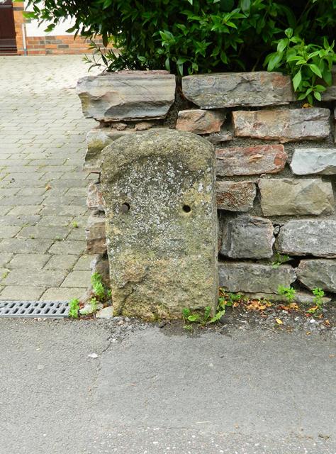
Image: © Alan Rosevear Taken: 4 Jul 2012
Stone post (plate lost) by the UC road (was A358), in parish of TAUNTON (TAUNTON DEANE District), Hamilton Road, by No.61, back of pavement against wall, on North side of road. Taunton roll top iron plate, erected by the Taunton turnpike trust in the 19th century. Inscription once read:- (1) (MILE) (To) (Taunton) Milestone Society National ID: SO_TAIM01
Images are licensed for reuse under creativecommons.org/licenses/by-sa/2.0
Image Location
Latitude
51.018073
Longitude
-3.081874