Old Milestone, Honiton Road, Trull
Introduction
The photograph on this page of Old Milestone, Honiton Road, Trull by JR Dowding as part of the Geograph project.
The Geograph project started in 2005 with the aim of publishing, organising and preserving representative images for every square kilometre of Great Britain, Ireland and the Isle of Man.

There are currently over 7.5m images from over 14,400 individuals and you can help contribute to the project by visiting https://www.geograph.org.uk
Old Milestone, Honiton Road, Trull
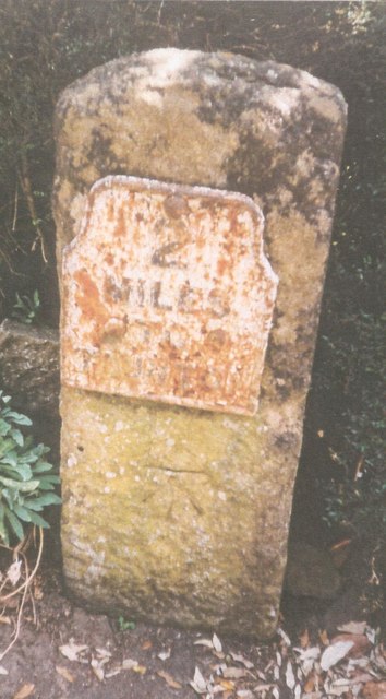
Image: © JR Dowding Taken: 1 Jan 2001
The milestone is located at the junction with Wyatts Field, on the pavement against the garden wall, on the east side of road. Parish of Trull (Taunton Dean District). Metal plate attached to stone post, Taunton roll top iron plate design, erected by the Taunton turnpike trust in the 19th century. Inscription reads:- 2 MILES To TAUNTON Carved benchmark lower front face. Grade II listed. List Entry Number: 1252522 https://historicengland.org.uk/listing/the-list/list-entry/1252522 Milestone Society National ID: SO_TATL02
Images are licensed for reuse under creativecommons.org/licenses/by-sa/2.0
Image Location
Latitude
50.992784
Longitude
-3.12218