Old Milestone by the B5203, Church Road, Rainford Parish
Introduction
The photograph on this page of Old Milestone by the B5203, Church Road, Rainford Parish by Milestone Society as part of the Geograph project.
The Geograph project started in 2005 with the aim of publishing, organising and preserving representative images for every square kilometre of Great Britain, Ireland and the Isle of Man.

There are currently over 7.5m images from over 14,400 individuals and you can help contribute to the project by visiting https://www.geograph.org.uk
Old Milestone by the B5203, Church Road, Rainford Parish
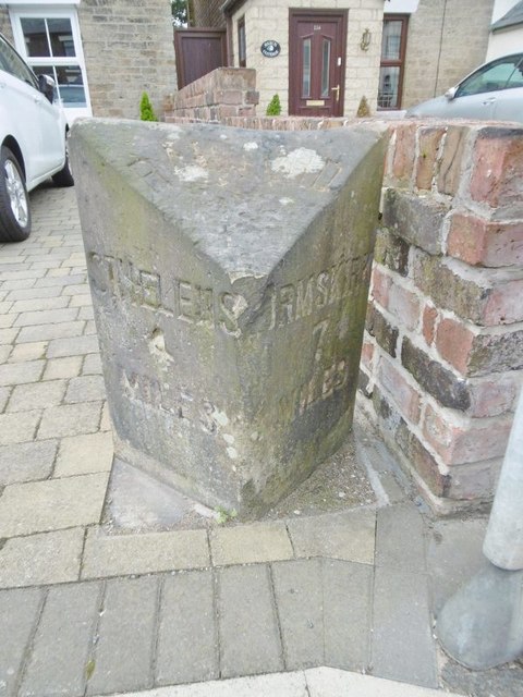
Image: © Milestone Society Taken: Unknown
Lancs CC stone triangle by the B5203 (was A570), in parish of Rainford (St Helens District), Church Road, Rainford, opposite junction with Rookery Lane against wall of No 116. Surveyed Milestone Society National ID: LA_SHOK04.
Images are licensed for reuse under creativecommons.org/licenses/by-sa/2.0
Image Location
Latitude
53.495522
Longitude
-2.78129