Old Wayside Cross at East Ogwell
Introduction
The photograph on this page of Old Wayside Cross at East Ogwell by Alan Rosevear as part of the Geograph project.
The Geograph project started in 2005 with the aim of publishing, organising and preserving representative images for every square kilometre of Great Britain, Ireland and the Isle of Man.

There are currently over 7.5m images from over 14,400 individuals and you can help contribute to the project by visiting https://www.geograph.org.uk
Old Wayside Cross at East Ogwell
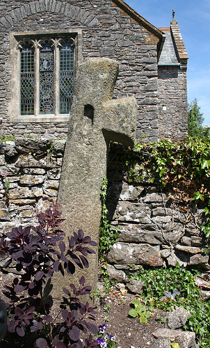
Image: © Alan Rosevear Taken: 22 Jun 2010
East Ogwell Cross, a moved wayside cross with an old head, shaft and base. Set on the south side of the southern churchyard wall about 5 metres east of the churchyard gate of St Bartholomew church, East Ogwell in Ogwell parish. Grade II Listed https://historicengland.org.uk/listing/the-list/list-entry/1249994. See also http://www.flickr.com/photos/tollhouses/4728041377. Milestone Society National ID: DVTE_OGG01
Images are licensed for reuse under creativecommons.org/licenses/by-sa/2.0
Image Location
Latitude
50.51859
Longitude
-3.640113